Thursday, December 9, 2010

Canal Park

PFBC Boat Ramp.


Canal Park over the years has become one of my favorite launching sites for kayaking the lower Lehigh. Before you venture to this destination though, I must offer some warnings. Since I have been going to Canal Park I have had my car broken into two times, have had a license plate stolen off of my car and have stumbled upon "couples" engaging each other in the pavilion and in cars. These events all happened on weekdays when I was working as a river guide on this section of river.
      Now that the downsides are out of the way, let's get into the highlights. For bikers and kayakers this is a great spot. Bikers can access a nicely maintained trail which runs from this park along the river all the way to Easton. The ride is pretty much flat with only a slight down grade all the way. For kayakers with only one car this might be the place for you. Normally you would be stuck fighting your way back upstream if you only have a single vehicle, but here you can take the canal which is almost stagnant on your route back (avoid the poison ivy on the side though). Fishermen can use the Pennsylvania Fish and Boat Commission boat ramp in the picture above and this section of river is deep enough for even powered boats. Remember if you use PFBC accesses though, you will need appropriate tags on the side of your boat. Non-powered boaters you can use the access pictured in the last photo below. No tags are needed as long as you do not use the ramps.
      When I visited this past Saturday there were very few people around. One boat with fishermen was drifting downstream as the men cast their lines. One biker passed by while I was taking photos and one man was standing by the railroad tracks camera in hand waiting for the train that was soon to pass. Other than that the park was empty. I took a short trip around collecting my photos and had a nice day remembering some of the good times I had working as a guide on this stretch.  

View Downstream from Ramp.
Boathouse and Pavilion.
Canal Boat Launch.
Canal.
Free Access.

Bucky Boil Park

Bucky Boil Park.


My first introduction to Bucky Boil Park was years ago. I was helping out with an event here during a rowing competition. Located in the center of Allentown it is a highly maintained park, that you really would not expect. It is hidden behind abandoned factories and is a glimmer of light in an area that has been depressed for a long time. On my first visit I was shocked, I had passed by the ally that leads to Bucky Boil, but always thought it lead to more forgotten structures.
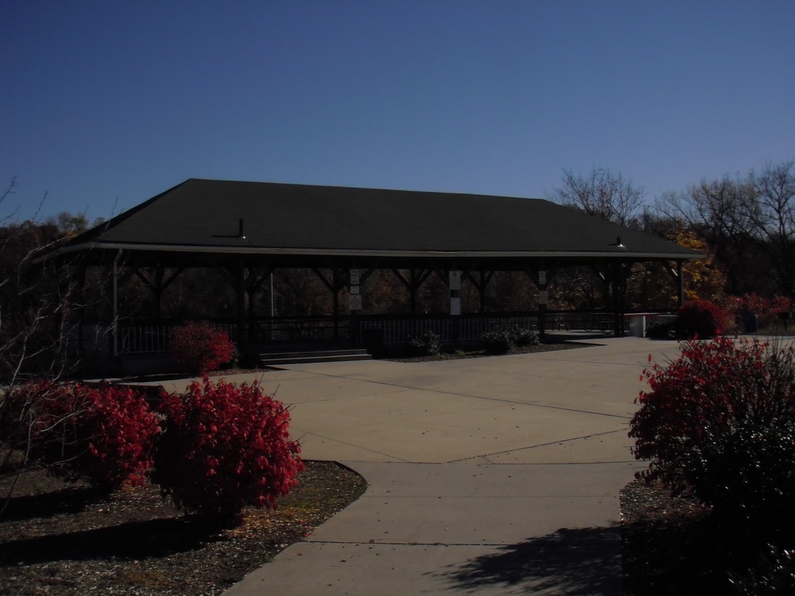
      I returned on a Saturday morning several weeks ago to take these pictures. I was surprised, when I pulled in, to see the parking lot was completely empty. The sun was shinning, the air was still and I thought I was alone walking around snapping photos. As I was taking the photo below of the pavilion, I was shocked when "Good Morning" came from a bench no more then five feet away from me. I wasn't alone. I nodded at the man who then sat up and I moved along on my way. I am adding this into my blog as a caution to you, my readers. I am almost certain this man was homeless and it is a common occurrence to run into these individuals near the river and in Parks around Allentown. I have had many run-ins with homeless and from personal experience, I know it is best to avoid them.
      Despite the startling "Good Morning" the park is really nice. In the past I know events such as the rowing competition I was at, occurred often during the summer. I am not sure if these events still run in the area. I believe Lehigh Universities rowing team practices here too, but I am not sure and could not find anything online supporting that.
      From the Pavilion you can see a unique sight on the river. Adam's Island is the only inhabited island on the Lehigh and unless you know someone who lives there you can only view it from a distance. Sadly, it is a private community and does not offer any access for recreation on the river.      
      
Dead End to the River.
Upstream View, Adams Island on Opposite Shore.
Downstream View.
Pavilion Overlooking River.
Remnants of Allentown's Industry.

Slatington and Walnutport

Looking Towards Walnutport.


There is parking for the D & L trail in Slatington, other than that though, there is not much on that side of the river.  Next to the parking area there looks to be a construction project to add new public facilities. The construction seems to be stalled for some reason and has been near completion for some time now. So, I ventured across the bridge to Walnutport.
        The D & L trail then picks up again in Walnutport and runs between the canal and the river. Here the canal is still functional, meaning it is filled with water, but not operational, so you won't see any canal boats moving along. I find this area to be peaceful and most of the time it isn't that crowded. For boaters there is not a launch on either side of the river here, but on the Walnutport side, there is a parking lot and easy portage to the river for the non-powered boaters.
         I know this hasn't been one of my best suggestions for a place to visit along my path, but it is an area that I do go to more than some other places along the river, so I thought I should add it.

Attention Fishermen: Slatington is another area in which I like to go night fishing. Haven't caught anything, but eels, it is still fun though. The last time I fished there I reeled in one that was pushing three feet and that is no anglers tale.     
Looking Towards Lehigh Gap.
Walnutport Canal.

Walnutport Canal.

Wednesday, December 8, 2010

Lehigh Gap to Slatington

Looking Away from Lehigh Gap to Slatington.


      From the Nature Center, I set off down the path towards Slatington by bike. I had only biked this section along the river once before and much of it I did not remember. Seeing the river brought back a lot of memories. I have paddled and inner-tubed it many times before. I was surprised at what all there was to see or discover through this section by way of land.
      There is the trail of course, nicely lined with railroad ties on one side and river on the other, as seen above, for those who want to hike and bike. For historians or those who would like to see a forgotten bit of the past, you can divert from the path and make your way down the steep bank of the river. Here you will find that the bank is man made, pictured below, it was quite a feet once accomplished and now lies unnoticed by most. Further towards Slatington the trail diverts away from the river and travels along side a small airport. A graveyard of old planes lines the runway and if you wait long enough you can see planes taking off and landing. All the sites make this a nice path to follow on a day off.
      I would suggest avoiding this path around Slatington on a warm summer day though. The towns sewage treatment facility also borders the trail close to town. It does let you know though that you have made it to Slatington.  


Click the Pic and You Might be Able to See the Plane Graveyard.
Remnants of the Past.
Looking Back to the Gap.

Monday, December 6, 2010

Lehigh Gap: Part II

Lehigh Gap Nature Center.


Opposite the Palmerton shore sits the Lehigh Gap Nature Center, formally known as the Wildlife Information Center. On weekends the Nature Center is run by a volunteer staff so it may or may not be open if you stop by. There are several parking areas, a newly finished boat ramp, an older portage access for canoes and kayaks and the D & L Trail runs right through the property, for bikers and hikers. In addition for the more advanced hikers there are several trails which run up the the side of the Gap and take you to the top of the Appalacian Mountain.
       During my visit I stopped in to the Nature Center. The last time I had been there, the land had just been purchased and little had been done to the existing building. Now it looks brand new with several additions. Through the enterance you are greeted with a small gift shop and reception desk. If you walk strait through the building you can go through the back doors and out onto their deck, which overlooks the Lehigh. If you take a left there is a decent size lecture room, that holds an advanced weather station system tucked away in a corner. For birders looking to add to their life lists this may be a location to check out. During migration you can sit on the deck watching for the passers by flying overhead and if you need to check the wind directions just head inside and check the station.
        Also for those interested in the birds pictured below is a table you might like. Along the Appalacian Mountain Range, stations are set up with bird watchers. All who record their daily sightings and the Lehigh Gap Nature Center offers you a glimpse into one of these stations. They have an intern who is stationed at Bake Oven Knob further west on the ridge and the table below is of his data. 


Bird Count.

Another Spot to get on the Trail.

Newly Added Boat Launch.

Friday, December 3, 2010

Lehigh Gap: Part I, Palmerton

Looking Toward the Gap.


If you have never been to Palmerton, Pennsylvania, you should definitely put it on a list of places to visit. You may have heard of Centronia, PA where the ground is on fire, well Palmerton is similar in the aspect of man made disaster. On the mountainsides surrounding the Palmerton you will see trees still standing that have been dead for over fifty years. The soil has been stripped away and in many places all that is left is bare rock. A single zinc smelting operation was to blame. I find it amazing what we as humans can do to our surroundings unintentionally and if you do too, make sure you visit this destination.
       Over the years projects have been put into place which have started to help the area rebound from this environmental catastrophie, so it is getting better. I enjoy the Palmerton side of the river in Lehigh Gap for fishing and swimming. Just a note: It is not a good idea to swim in any river without a personal floatation divice (PFD). There is no biking path along this side of the river in this location, but if you walk downstream from Palmerton you can find the old canal and some of its sections are hikable.
       For fishermen, this is my favorite place for night fishing along the entire Lehigh River. This year I caught more catfish at this location than all the others combined that I fish on the Lehigh. I have also reeled in carp, rockbass and eels during my nighttime excursions here.

Wednesday, November 17, 2010

Bowmanstown

RiverView Park. Rules and Regs.


One of the newest parks along the Lehigh River Riverview came into existence only about four years ago. It started with the boat ramp pictured below and a couple pull off access sites. Until this past Sunday I thought that was all that it was. To my surprise I found a brand new disc golf course outside of the main parking lot, pics below. On the opposite end of the main parking lot from the course it looks as though something else is being added to the park. A large area has been clear. It may just be an addition to the parking area or it may be a new surprise coming soon.   
     This is a great launch point for kayaks and canoes. Make sure they have the proper tags though, this like all of the Pennsylvania Fish and Boat Commission access sites is patrolled. I would not suggest launching a powered boat here but I have seen individuals do so. The river gets shallow quickly both up and down stream and small rapid sections can be found in both directions. This past summer I started using this access for night fishing. Out of three tries at this location I only pulled up one small catfish, you can try it too, but if you would like better places contact me and I can suggest some. Or keep reading my blog because some of the better fishing sites are coming up soon.

PFBC Boat Ramp.
View from the Ramp.
Disc Golf.
Score Cards and Pencils Ready.
Can You See the Hole?